
Dream tour Marktbreit - Obernbreit
This tour at the southernmost point of the Main triangle is a fantastic interplay of art, culture, nature and landscape. Stunning views from the Main valley to the Steigerwald forest await you.
Marktbreit
5 h
11 km
The hike at the southernmost point of the Main triangle is characterised by a variety of natural beauty, culture and art. The once important trading town of Marktbreit and Markt Obernbreit are surrounded by romantic paths and hiking trails with stunning views from the Main valley to the Steigerwald forest.
On your way you will see the Chapel of the Holy Cross, the former synagogue with its cuppa stone and 10 metre deep mikvah (ritual bath), the Obernbreit Renaissance town hall with the bronze sculpture "Hucklkätz". You walk through the "Obernbreiter Kanzel" vineyard, where a unique view of the Schwanberg, the wine paradise and the Uffenheimer Gau awaits you.
A hiking tour for nature lovers and explorers
Start and end station
11 km / 5 Stunden
Our tip: Please make sure to check your train connection and the expected capacity before you start your journey.
Schedule
Tour starts on
Direction
From the station square, turn left and cross the railway tracks in a southerly direction.
From the Einheimer Steige road, take the turn-off to the left and walk along the edge of the forest and along fields in an easterly direction towards Obernbreit.
The route is already slightly uphill here and offers beautiful views far into the landscape of the Maindreieck.
After about two kilometres, you will pass the Galgenbergbrünnle, which is surrounded by small walls, somewhat hidden in the grass and carries a little water.
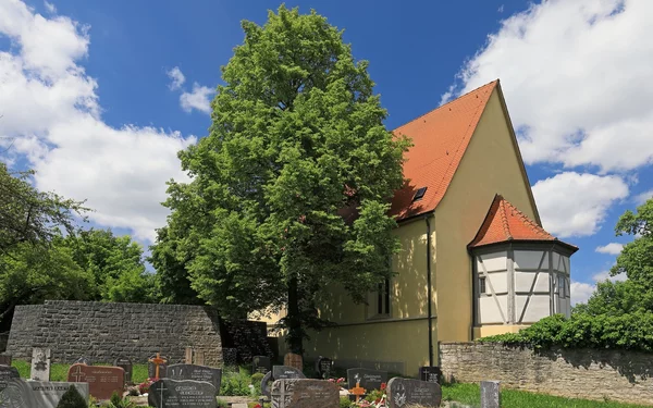
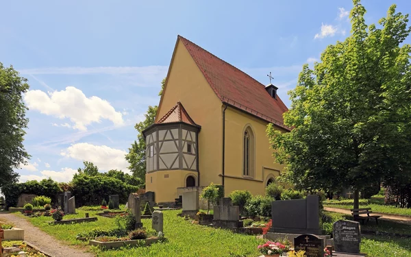
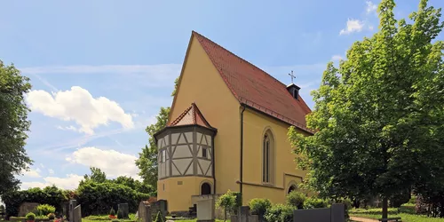
If you follow the road straight ahead, you will reach the Obernbreit cemetery, at the end of which you will find yourself in front of the Chapel of the Cross. This was a place of pilgrimage centuries ago.
Holy Cross Chapel
The chapel was first mentioned in a document in 1301, here still as the "Church of the Holy Cross". It served as a pilgrimage chapel. In 1584, the cemetery was laid out around the Holy Cross Chapel. The cemetery around the parish church in the centre of the village was closed. In 1590, the new churchyard received its gate. In 1595, the church was renovated, the nave was raised and Gothic tracery windows were installed. The entrance was moved to the north side, perhaps due to the installation of a new gallery.
On 25 July 1699, the funeral bell rang for the first time in the Obernbreit cemetery. In 1716, the church received an organ. In 1783, the cemetery was extended by around 1,000 square metres and walled in. The cemetery chapel was renovated again in 1961 and the electric bell system was installed in 1974.
On 5 and 6 March 1942, the bell of the cemetery chapel, together with two bells from the parish church cast in 1892, were confiscated by the Nazi rulers for the war economy. Only the cemetery bell returned on 21 September 1947 and was led in solemn procession to the cemetery chapel.
The chapel was thoroughly renovated and restored again between 2009 and 2010.
Direction
After passing under the railway line, you will reach Enheimer Straße in the village of Obernbreit. Follow the road until you can turn left into Kirchgasse. A little further ahead you will find Obernbreit's former synagogue.
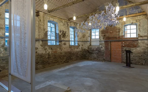
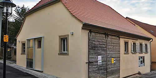
Former synagogue
In 1748, the Jewish religious community of Obernbreit built a synagogue and used it until the community was dissolved in 1911. The building was sold the following year and changed hands six times over the course of 100 years.
It was used as a barn, repair shop and storage room. Each user remodelled it according to their needs, removing parts and adding new ones. A large opening was made in the southern façade to allow large agricultural equipment to enter, the neck of the cellar above the entrance to the mikvah was filled in to gain space and the floor was given a thick concrete covering. A mezzanine floor was added so that almost nothing inside or outside the building was reminiscent of a synagogue.
Through painstaking research, the interior of the former synagogue was partially reconstructed. Records from an old family chronicle and research carried out as part of a doctoral thesis were helpful here.
An old wedding stone (chuppa stone) in the shape of a Star of David was found in the walls of the synagogue. The original mikvah, the ritual bath, was uncovered in 2007 and is unique in this state of preservation in Lower Franconia.
An der Synagoge 1
97342
Obernbreit
Direction
You cross the village heading north, passing the market square and the "Hucklkätz" sculpture in front of the town hall, which is a reminder of Obernbit's former village life.
You walk out of the village again on Kitzinger Straße. The route is now well uphill.
In the middle of the Obernbreit wine-growing area, you reach the "Obernbreiter Kanzel" via the Rebsortenweg. Wine has been grown here for centuries. From the viewing platform of the pulpit, you have an impressive view of the Breitbach valley and across to the Steigerwald forest.
A little further on, the view of the Schwanberg is impressive.
Past orchards and in the shade of the forest, the path crosses the Schwedengraben.
Now you walk above Marktbit with a wonderful view of the Main, especially from the hill of St Moritz Chapel.
You return to Marktbreit via the steps at Stutz. The Malerwinkelhaus museum is located where the Kapellensteige meets the Bachgasse, near the town hall.
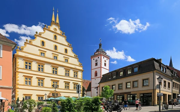
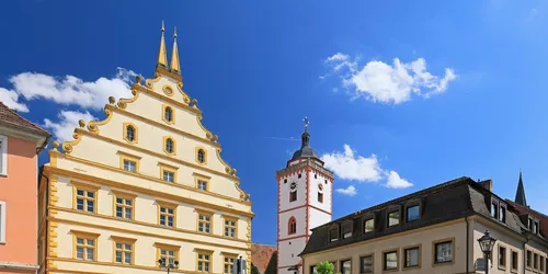
Museum Malerwinkelhaus and Main Gate
Originally dating back to the 17th century, the Malerwinkelhaus, situated on the Breitbach stream, forms a unique ensemble with the Main Gate, which was built around 1600.
While the building served as a general store and business premises for centuries, since its restoration in 1991 it has been home to the Malerwinkelhaus Museum of the town of Marktbreit. It houses the permanent social and cultural history exhibition "Frauen-Zimmer. Stages of life in a small Franconian town" and the permanent archaeological exhibition "Roman Cabinet".
Changing special exhibitions on cultural-historical themes complete the programme.
Bachgasse 2
97340
Marktbreit
Direction
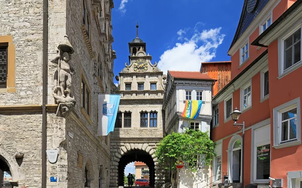
After a few steps you have reached the Marktbreit town hall.
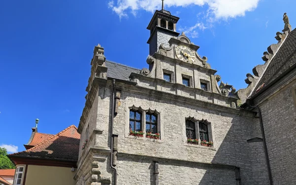
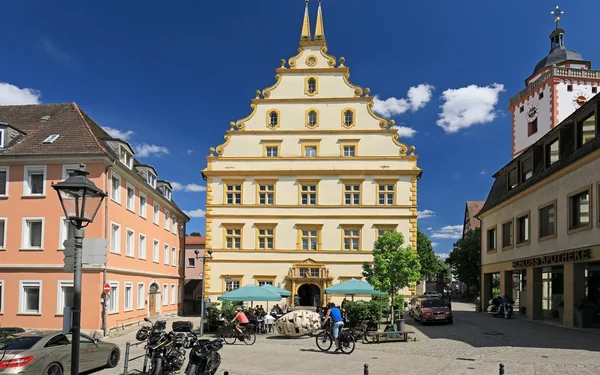
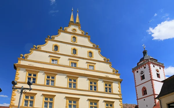
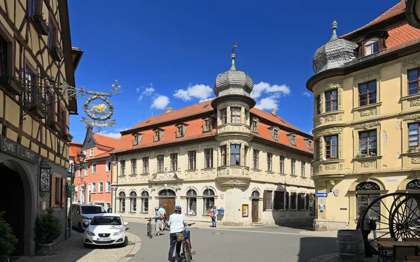
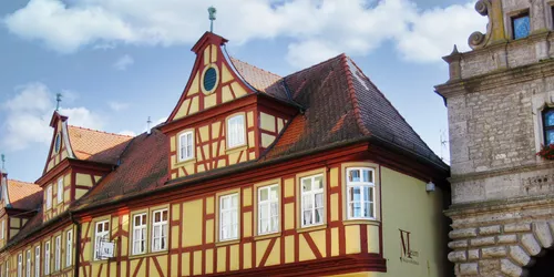
Renaissance town hall
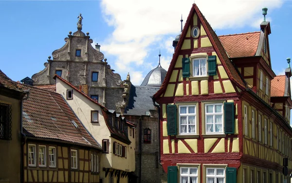
The Renaissance-style town hall was built in 1579/81 according to plans and under the direction of the stonemason and master craftsman Hans Keesenbrod from Segnitz.
Marktbreit was an important trading centre between Würzburg and Regensburg in the Middle Ages.
The house was a multifunctional building, with a market hall in the basement, council chamber and consistorial parlour on the upper floor.
The statue of the knight St George, who kills the lindworm with his lance, stands on the corner, as well as on the gable end, as a symbol of the market town. The statue of St George on the gable was the symbol of the customs law for shipping on the Main and could be seen from afar by boatmen on the river. The statue at the corner of the town hall symbolised market justice. On the first floor is the festival hall and the richly panelled former council chamber, now the wedding hall.
Marktstr. 4
97340
Marktbreit
Direction
Now follow Marktstraße southwards and you will come to Schlossplatz, where you will be standing in front of Seinsheim Castle.
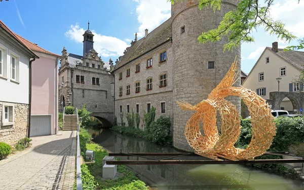
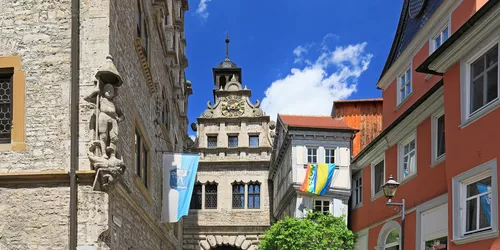
Seinsheim Castle
Seinsheim Castle was built in 1580 for the imperial and prince-bishop's councillor Georg Ludwig von Seinsheim (1514 - 1591). The result was a representative building in the style and spirit of the Renaissance.
From 1865, Seinsheim Castle became Schwarzenberg's official residence and the seat of the official administrator. Following renovation work in 1994, the ground floor now houses a café and a wine bar, while the first floor houses the town library and the town archives.
Schlossplatz
97340
Marktbreit
Tour ends on
Direction
You reach Marktbreit railway station via Bahnhofstraße.
We recommend stopping off at one of Marktbreit's excellent restaurants. For example, the restaurant directly in Marktbreit Castle, where you can enjoy seasonal and Franconian cuisine.
Or you can stop off at the Fränkischer Hof restaurant in Bahnhofstraße, where a selection of hearty and refined dishes awaits you.